|

Primary Mound
|
Secondary Mound
|
Restored Wall
|
Aztalan Museum
|
Princess Mound
Aztalan Home
|
Directions
|
Synopsis
|
Story (12/98)
|
Slide Show
|
Books
|
Links


Aztalan, Wisconsin is located in southern Wisconsin, between Madison and Milwaukee. It can be reached from
either city via Interstate 94, which connects with County Road Q. Follow County Road Q southwest, then south
until it crosses County Road B. Aztalan is located just southeast of this intersection.


When I.A. Lapham mapped the site in 1850, there were over 40 mounds in this area. During the settlement
period, however, most of the mounds had been plowed under to open up further land for cultivation.
Fortunately, around the turn of the century, archaeologists and local historians managed to save the
remaining mounds. Aztalan was then made into a public park in 1952, was designated a National Landmark in
1964, and was listed in the National Register of Historic Places in 1966.
Before plowing took its toll, evidence of large stockade walls, large platform mounds, ancient farm
fields and numerous mound and pit features dotted the 172 acres which now comprise the park.
Archaeological excavations, beginning in 1919, have helped to reconstruct some of these features.
We now know that Aztalan was a flourishing community from AD 900 to AD 1200, after which time all the
inhabitants left. The reason for this abandonment is still a mystery.
Though much of the original city has been destroyed, there is still much to see:
(1) The
primary mound
, which is comprised of two levels;
(2) The
secondary mound
, which has only one level;
(3) The
stockade wall
, parts of which have been restored.
Other points of interest include:
-
Princess Mound
, where the burial of an Indian princess was uncovered;
-
Aztalan Museum
, which includes numerous Indian artifacts from Aztalan and the surrounding area.
Click
here
for a panoramic view of the site, taken from the secondary mound. Note that the primary mound can be
seen in the distance.

Books

 Lost Cities of North and Central America
David Hatcher Childress
Rating:    
I enjoy Childress' books mainly because he comes across as very honest, although he engages in too much speculation to be taken at face value. Overall I find his books a very engaging read, and the speculative aspect, though often unscientific, is very entertaining. Moreover, the amazing amount of study and travel he has done brings a certain amount of credibility to his work. If you are a maverick archaeologist, Childress' Lost Cities series is for you.
Click
here
to buy this book.
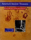
 America's Ancient Treasures: A Guide to Archaeological Sites
and Museums in the United States and Canada
Rating:    
Franklin Folsom
America's ancient treasures (1993 edition) is a reprint of a classic first printed back in 1971. It contains a thorough recounting of every major and most minor Native American archaeological sites and museums in North America, and is an excellent resource tool for those interested in a serious exploration into North America's ancient past.
Click
here
to buy this book.
 Wisconsin: Off The Beaten Path
Martin Hintz, Dan Hintz
Click
here
to buy this book.
The Lost Pyramids of Rock Lake : Wisconsin's Sunken Civilization
Frank Joseph
Click
here
to buy this book.
Atlantis in Wisconsin: New Revelations About the Lost Sunken City
Frank Joseph
Click
here
to buy this book.
 Wisconsin's Past and Present: A Historical Atlas
Wisconsin Cartographers Guild, William Cronon
Despite Wisconsin's rich history, no historical atlas has been produced in the state since 1878. The Historical Atlas of Wisconsin, created by the Wisconsin Cartographers' Guild, has filled this void with a fascinating and colorful portrait of the state's complex development. This useful and entertaining guide, produced to mark 150 years of statehood, provides a lasting resource for map lovers and history buffs of all ages, and anyone interested in Wisconsin's heritage. The Atlas features more than 100 pages of historic and geographic data, including full-color maps, descriptive text, photos, and illustrations.
Click
here
to buy this book.
 Ancient Aztalan
Samuel A. Barrett
Click
here
to buy this book.
Alexander Von Humboldt, Colossus of Exploration
Ann Gaines, Michael Collins (Photographer)
Alexander von Humboldt's extraordinary reputation as the foremost man of science of his day is amply justified in this exciting, factual, yet carefully integrated discussion of his explorations and studies. An interesting biography of a man who should be better known. Bibliography, index. -- Copyright � 1991 The Horn Book, Inc. All rights reserved. --This text refers to an out of print or unavailable edition of this title.
Click
here
to buy this book.
Links

AZTALAN:
 Mr. Neefe's Social Studies Web Project: Aztalan
 Minnesota State University, Mankato Anthropology Dept's "E-Museum": Aztalan
 Legendary Lake Mills
ROCK LAKE:
 Found: The Lost Pyramids of Rock Lake (Science Frontiers #66, Nov-Dec 1989)
ILLINOIS
|
INDIANA
|
IOWA
|
KANSAS
|
MICHIGAN
|
MINNESOTA
|
MISSOURI
NEBRASKA
|
NORTH DAKOTA
|
OHIO
|
SOUTH DAKOTA
|
WISCONSIN
WEST
|
SOUTHWEST
|
MIDWEST
|
SOUTH
|
NORTHEAST
UNITED STATES
|
CANADA
|
CENTRAL AMERICA
|
CARIBBEAN
NORTH AMERICA
|
SOUTH AMERICA
|
EUROPE & EURASIA
|
AFRICA
MIDDLE EAST
|
ASIA
|
AUSTRALIA & THE PACIFIC
BACK TO WORLD MAP
|


 Lost Cities of North and Central America
 America's Ancient Treasures: A Guide to Archaeological Sites
 Wisconsin: Off The Beaten Path
 Wisconsin's Past and Present: A Historical Atlas
 Ancient Aztalan